Microdrones mdLiDAR1000LR aaS
Product code: mdLidar1000LR_BL_en
Brand: Microdrones GmbH
Guarantee: 12 months


Transport Gratuit
Comenzile peste 500 de lei beneficiază de transport gratuit. Taxa standard de livrare este 20 de lei, iar pentru zonele care nu se află în raza de acoperire a curierului costul poate fi mai mare

Retur - 14 zile
Orice produs achiziționat online poate fi returnat, legal, în termen de 14 zile, cu mențiunea că plata transportului la returnare îi revine clientului. Produsul nu trebuie să prezinte urme de uzură.

Ai nevoie de ajutor?
Pentru orice nelămurire legată de o comandă sau doriți să verificați disponibilatea unui produs, vă stăm la dispoziție prin email office@blacklight.ro sau telefonic la unul din numerele 0356 808 870 / 0264 484 982 / 0745 252 583
Description Product specifications Reviews
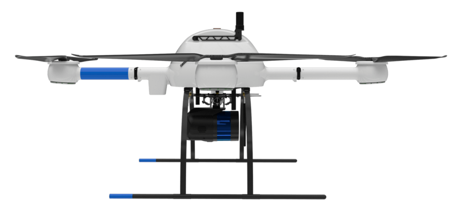
Microdrones presents their first fully integrated LIDAR drone system, in partnership with the industry leader md4-1000. This UAV is specially built for professional and commercial applications and uses. LIDAR is known as the most important technology for capturing geospatial data. This platform can be used in a variety of different industries and applications, including mining, construction, environmental change over time, forestry, gradient mapping, and more.
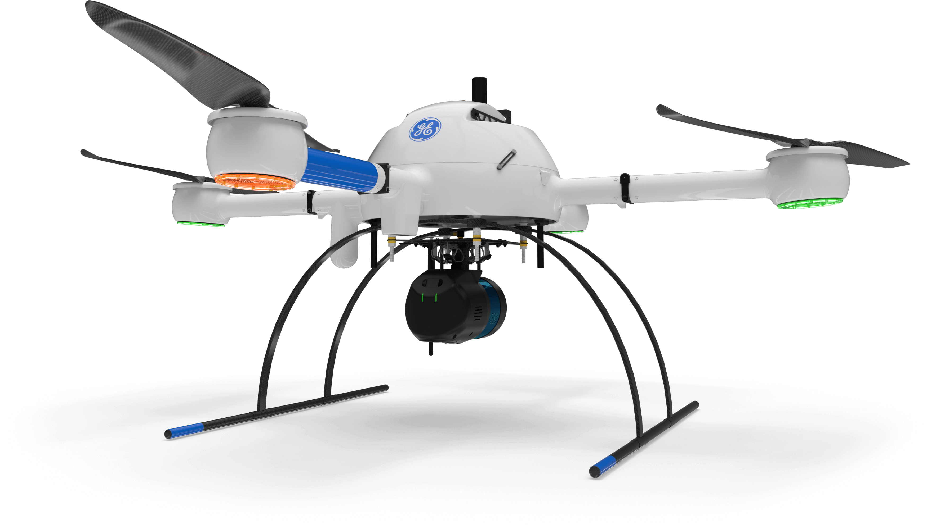
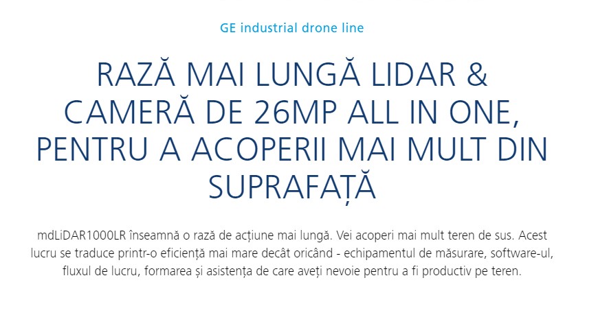
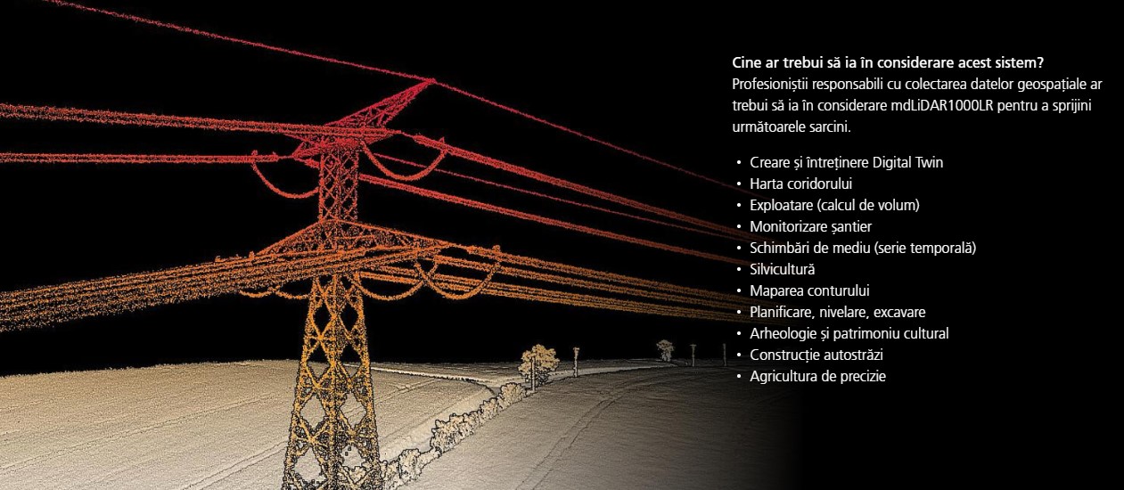



mdLiDAR1000LR increases the distance from which details can be captured. It can capture power line details at 75 m for distribution and 90 m for transmission, effectively doubling the range of the mdLiDAR1000HR system. The flight at 70 m from the power lines, at 8 m / s allows the efficient location of the power lines with about 10 points per linear meter and the capture of the excellent details of the towers.
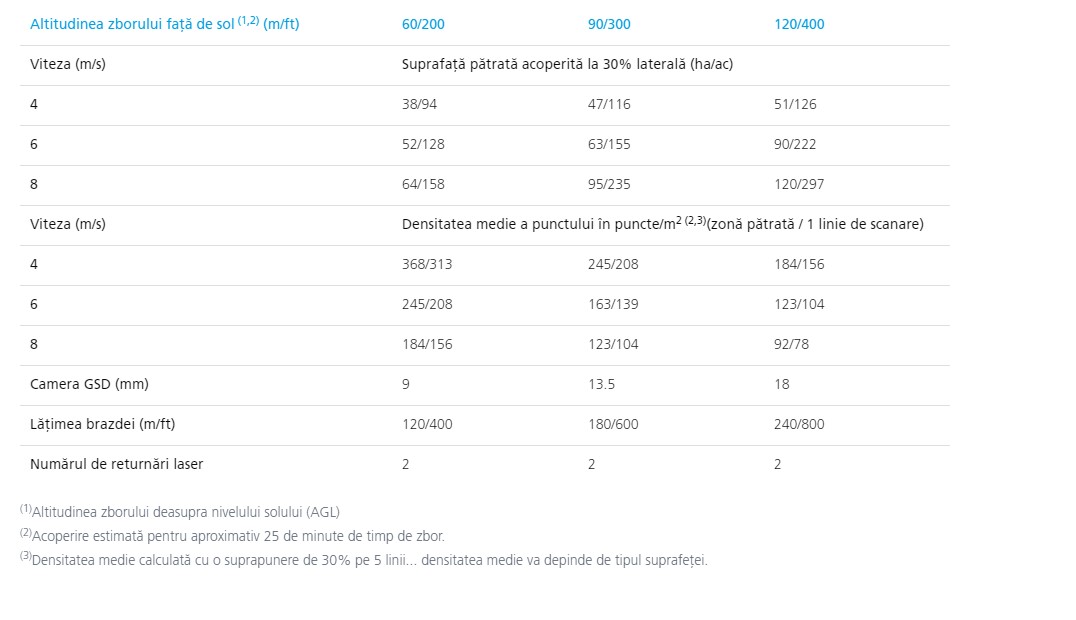
mdLiDAR1000LR is also a great tool for scanning large mines and measuring stock volumes. Flying at 100 m AGL with 20% lateral, LR can cover over 1.2 square kilometers in a 30-minute flight, capturing a point density of 150 points per square meter.
Microdrones has developed an end-to-end LiDAR solution that combines a drone, a payload LiDAR, fully integrated LiDAR processing and a world-class photogrammetry software and support workflow to consistently deliver quality results.
mdLiDAR1000LR is a fully integrated 3D point cloud production system optimized for topography, construction, oil and gas, and mining applications.
Improved image acquisition, precisely configured to fit the laser scanner's field of view, allows compatibility with efficient point cloud coloring and FORMap data processing modules within the mdInfinity platform.
Each LidAR channel of the mdLiDAR1000LR is calibrated to improve data consistency, thus providing reduced standard measurement uncertainty.


The mdLiDAR1000 consistently delivers 6 cm (0.2 ft) accuracy when flying at 40 m (130 ft) at a speed of 3 m / s (6.7 mph).
Technical specifications:
- UAV platform md4-1000: robust multirotor, Mag-les navigation, remote ID, Led Light Rings, GroundCollision, Avoidance, IMU for georeferencing;
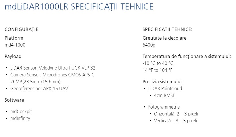
- fully integrated high resolution LiDAR sensor: Velodyne PUCK VLP-16, 16 channels, 300,000 dots per second (single return mode), 600,000 dots per second (dual return mode) + fully integrated SONY IMX264 high resolution camera - for point cloud coloring;
- Payload weight: 6.5 kg;
- System operating temperature: -10 ° C to 50 ° C.
The configuration includes:
- 1 x md4-1000 multirotor UAV platform;
- 1 x LID Velodyne PUCK VLP-16 LiDAR Sensor + SONY IMX264 Highly Integrated High Resolution Camera;
- 2 x batteries;
- 1 x battery charger;
- Flight planning software included: mdCockpit;
Microdrones mdInfinity post-processing software access. Permanent licenses are not included; post-processing available on demand based on tokens.
Support included: 1 year.
Warranty: 1 year.
Category: Multirotor UAV
Brand: Microdrones GmbH
No review

Microdrones mdLiDAR1000LR aaS


0 reviews
Add review


Similar products


 The product has been successfully added to the cart!
 Your opinion has been recorded.
 The price alert has been registered
 Str. Virtuții, nr.1, Timișoara 300126, Timiș
